
Tree Thinning in Ridgway, Colorado: Healthier Forests, Lower Wildfire Risk
By Fire Guard LLC
Defensible Space | Residential & Commercial | Beetle Kill Removal | Free Estimates
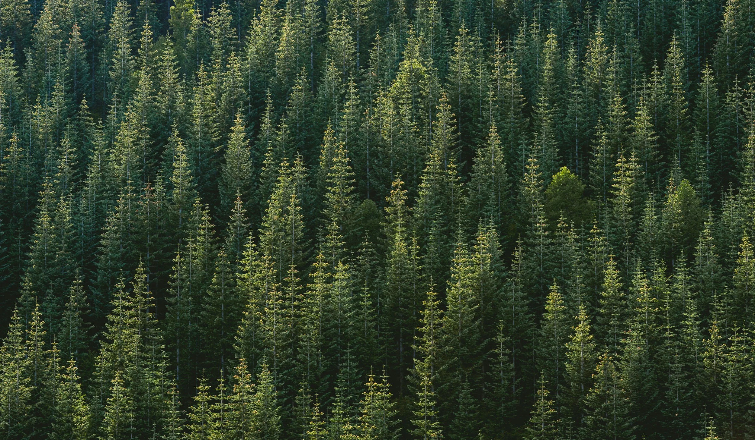
The ponderosa pine and mixed conifer forests on Log Hill Mesa and the transition zones around Ridgway are among the most densely stocked in Ouray County, and among the most heavily affected by mountain pine beetle kill. A century of fire suppression has produced stand densities well above the historical fire-maintained range, and beetle kill has layered a significant dead fuel load on top of that existing density. Professional tree thinning near Ridgway is the most direct path to restoring open, resilient forest structure and reducing the fire risk that defines the landscape around Log Hill Mesa.
What Is Tree Thinning and Why Is It Necessary?
Tree thinning is the selective removal of trees to reduce overall density, improve the health of remaining trees, and reduce the horizontal fuel continuity that allows fire to spread through a forest canopy.
Ponderosa pine on Log Hill Mesa and the Ridgway transition zones were historically maintained by frequent, low-intensity surface fires. Fire suppression eliminated that process. The result is visible throughout the mesa: dense ponderosa stands competing for limited water, stressed root systems, high beetle kill rates, and fuel loads the historic forest never carried. Tree thinning restores what fire once maintained.
What Can Tree Thinning Service Include
Fire Guard LLC's land clearing service is comprehensive. Every project depends on the property, homeowner goals, insurance and more. Every project has the option to include:
Site Assessment and Spacing Plan
Before cutting begins, Fire Guard LLC assesses existing tree density, species composition, beetle kill extent and phase, proximity to structures, slope and aspect, and your goals for the land. We develop a thinning plan specifying which trees to remove and which to retain. This assessment is free.
Selective Removal of Priority Trees
Our thinning prioritization near Ridgway focuses on:
Mountain pine beetle-killed ponderosa pine: grey and red-phase snags within defensible space zones, prioritized by proximity to structures and slope position.
Diseased and declining ponderosa: trees with significant die-back, mistletoe infection, or bark beetle attack that survived but left the tree weakened and likely to die within a few years.
Suppressed and overcrowded trees: smaller trees growing in the shade of dominant trees are weaker and more stressed.
Gambel oak clusters within defensible space zones: dense oak on the mesa edges and in the transition zones, contributing significant surface and ladder fuel.
Trees creating canopy continuity: specific trees whose crown position links separated groups and enables fire spread across the mesa surface toward structures.
Crown Spacing Verification
After removal, we verify that remaining trees meet appropriate crown-to-crown spacing for your zone designation. We account for slope adjustments on Log Hill Mesa's varied terrain, from the flatter mesa top to the steeper faces above the Uncompahgre valley.
Slash Management and Removal
Thinning generates significant volumes of cut material. We chip, haul, or otherwise dispose of all slash. On the mesa, slash piles left on site create concentrated fuel that undermines the thinning work done around them.
Why Tree Thinning on Log Hill Mesa Addresses a Specific Community-Scale Problem
Neighborhood-Level Fuel Continuity
Log Hill Mesa's residential development pattern, homes on lots of one to ten acres with ponderosa pine and Gambel oak between them, creates a community-scale fuel continuity problem that individual property thinning alone cannot fully solve. A well-thinned property surrounded by unthinned neighbors still faces elevated risk because fire can approach through adjacent fuel. The most effective fire risk reduction on Log Hill Mesa happens when multiple neighboring properties are thinned together or in the same season, creating a neighborhood-scale fuel break rather than isolated defensible space islands.
Fire Guard LLC works with Log Hill Mesa HOAs and property owner groups to coordinate thinning projects across multiple parcels. Group projects are more efficient, reduce per-property mobilization costs, and produce genuinely better fire risk outcomes at the neighborhood level. If you are a Log Hill Mesa HOA board member or a property owner interested in coordinating with neighbors, Fire Guard LLC can advise on how to structure a group project and what the planning and permitting process looks like.
Pre-Mortality Ponderosa Identification
On Log Hill Mesa, beetle-killed standing snags are easy to identify. More valuable, and harder to identify without training, are the ponderosa trees currently under beetle attack or in the late stages of drought stress that will become snags within the next two to three years. These trees look green or partially green, but their resin production is declining, their pitch tubes are present, and their root systems are compromised. Removing pre-mortality trees during a thinning project is more cost-effective and produces better long-term defensible space than treating them after they die. Fire Guard LLC assesses tree vigor, not just visible kill, in every Ridgway-area thinning evaluation.
Ouray County Requirements
Ouray County has defensible space requirements that include tree thinning standards for properties in wildfire hazard zones. Fire Guard LLC can document all completed thinning work for county and insurance compliance.
What Wildfire Risk Tools Tell Us About Ridgway and Log Hill Mesa
The USFS Wildfire Hazard Potential (WHP) map rates significant portions of the terrain around Ridgway as High to Very High wildfire hazard. Log Hill Mesa, with its ponderosa pine and oak brush transition zones, its exposure to south and southwest winds, and its proximity to the Uncompahgre Canyon, carries a particularly elevated risk. The mesa's development over the past two decades has placed hundreds of structures in terrain that fire behavior modeling consistently flags as high-risk, and insurance carriers are increasingly applying satellite-based vegetation assessments that reflect this rating.
Properties on Log Hill Mesa and in the forested transition zones south and east of Ridgway are among the most commonly flagged for elevated premiums and non-renewal in Ouray County. Documented tree thinning with visible, measurable cleared zones is the most direct response.
The practical implication: Tree Thinning that creates measurable, visible defensible space. It's increasingly a financial necessity, affecting your insurability, your property value, and your community's emergency response options. Fire Guard LLC has all of the tools and resources to help protect your home.
Want to see Where Your Home is on the Map? Click the Button Below to Learn More
Why Fire Guard Colorado?

Fire Guard Colorado is owned and operated by Sam Tyler, a certified Fire Mitigation Specialist with a degree in Fire Science and five years of wildland fire experience. His background on the fire line gives him direct knowledge of how wildfires spread and what actually helps firefighters defend homes.
Sam has eight years of experience with the Ouray Fire Department, whose district covers the terrain directly south of Ridgway along the Uncompahgre corridor. He also serves with the Telluride Fire Protection District to the west. Between these two departments, Sam has direct operational familiarity with the entire terrain arc that defines wildfire risk for Ridgway-area properties — the Cimarron foothills to the east, the Uncompahgre canyon approach from the south, and the forested mesa terrain to the west toward Norwood.
Fire Guard LLC serves Ridgway, Log Hill Mesa, Pleasant Valley, and surrounding Ouray County properties as a core service area. We also serve the broader Southwest Colorado region, including Ouray, Norwood, Montrose, and Telluride. We work on residential lots, multi-acre parcels, ranch land, HOA common areas, and commercial properties. Our extended service area now includes La Plata County (Durango, Bayfield, Ignacio, and Hesperus), Archuleta County (Pagosa Springs, Pagosa Lakes, Arboles, and Chimney Rock), Montezuma & Dolores Counties (Cortez, Dolores, and Mancos) San Juan County (Silverton and surrounding high-country areas). Willing to travel beyond these regions for specialized projects.
Frequently Asked Questions: Tree Thinning in Southwest Colorado
-
Thinning is nothing like clear-cutting. Clear-cutting removes all or nearly all trees from an area. Wildfire mitigation thinning is selective, we typically remove 30–50% of trees in overcrowded stands, leaving a healthy, well-spaced forest that often looks dramatically more open and beautiful than the crowded stand we started with. Clients frequently tell us the property looks better after thinning than it has in decades.
-
The primary species we thin on Southwest Colorado properties include ponderosa pine, lodgepole pine, Engelmann spruce, Douglas-fir, subalpine fir, and blue spruce. We also manage Gambel oak thickets as part of combined thinning and brush clearing projects. Each species has different spacing requirements and fire behavior characteristics our team has extensive local experience with all of them.
-
Small residential properties (under 3 acres) often take 1–3 days. Larger acreages and ranch properties are scheduled based on a site assessment. We'll provide a realistic timeline and work to minimize disruption to your property and routine.
-
Not necessarily. Once the thinning plan is agreed upon and marked, our crew can work independently. We photograph the work and check in at key stages. Many clients prefer this approach. You come back to a transformed property without dealing with the logistics of the workday.