
How to Make Your Rural Home Safer From Wildfires
By Fire Guard LLC
Defensible Space | Residential & Commercial | Free Estimates
A complete, practical guide for homeowners in Southwest Colorado's wildland-urban interface that covers the specific threats facing rural properties and the steps that have the highest documented impact on home survival.
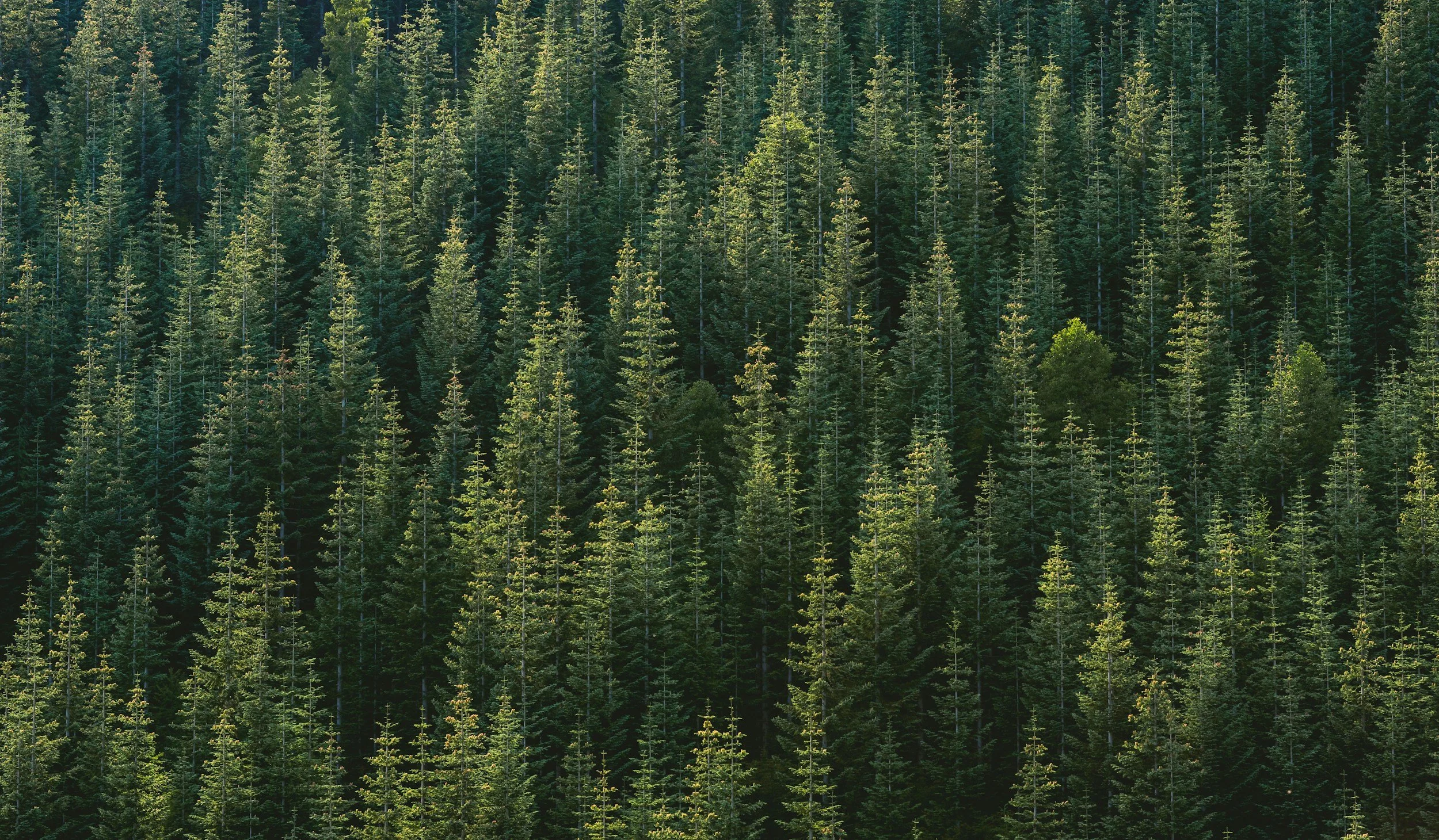
The Rural Wildfire Reality in Southwest Colorado
If you own a rural home in Southwest Colorado you are living in what fire scientists call the wildland-urban interface (WUI). This is the zone where human development meets wildland vegetation, and it is Colorado's highest-risk environment for catastrophic wildfire losses.
The National Interagency Fire Center documents that more than 80% of homes destroyed in U.S. wildfires are lost in WUI conditions, the landscape that defines most rural Southwest Colorado properties. The encouraging reality is that research consistently shows homes with properly implemented mitigation measures survive at significantly higher rates than unprotected neighbors, even in severe fire events. The difference is almost always the choices made before fire arrives.
Step 1: Create and Maintain Defensible Space
Defensible space is the single most impactful action a rural homeowner can take. Post-fire structure survival studies from the Insurance Institute for Business & Home Safety and USFS researchers consistently identify it as the primary differentiating factor between homes that survive and homes that don't. For rural Southwest Colorado properties, this means:
Zone 1 (0–30 ft): Remove all combustible shrubs and vegetation. Mow grass under 4 inches during fire season. Clear pine needles from roof and gutters. Eliminate wood piles, propane storage, and combustible items stored against the home.
Zone 2 (30–100 ft): Thin trees to 10+ feet between crowns. Remove brush and shrub masses forming continuous fuel beds. Limb up trees to 6–10 feet. Remove all beetle-killed trees and standing dead wood.
Zone 3 (100–200 ft where possible): Thin additional vegetation, remove beetle kill, break up continuous fuel beds on approaches to the home.
Slope adjustment: On Southwest Colorado's steep terrain, fire moves significantly faster uphill. Extend defensible space distances upslope — many fire safety professionals recommend doubling Zone 2 distance on slopes exceeding 30%.
Step 2: Remove Beetle-Killed and Dead Trees
The mountain pine beetle has killed millions of trees across Southwest Colorado over the past two decades. Red-phase beetle-killed trees, identifiable by brown needles still attached to grey standing trunks, are among the most dangerous individual fuel elements in the Colorado landscape. They can torch explosively, throwing burning embers hundreds of feet and igniting structures far ahead of the main fire front.
Rural property owners should prioritize removal of beetle-killed trees within and around defensible space zones, with particular urgency for trees: within 100 feet of structures, positioned upslope from buildings (where falling embers travel farthest), and in groupings that would sustain intense burning for extended periods.
Step 3: Clear Brush and Eliminate Ladder Fuels
Brush clearing and ladder fuel removal are the engines of a complete rural fire safety plan. Key actions:
Remove or significantly thin Gambel oak, sagebrush, serviceberry, and other dense shrub masses in Zone 1 and Zone 2.
Eliminate continuous fuel beds. No connected ground-level vegetation from the property perimeter to the home.
Limb up all trees to 6–10 feet to eliminate the vertical fuel pathways that turn surface fires into crown fires.
Clear accumulated debris, downed logs, and dead wood from the defensible space zones.
“The most common way rural homes burn in Colorado wildfires isn’t the main fire front reaching the structure; it’s embers landing on a debris-filled gutter, igniting a brush pile stored under the deck, or finding an unscreened vent.”
Step 4: Harden Your Home's Exterior
Post-fire research from USFS and state fire agencies shows many homes ignite from embers, firebrands blown ahead of the fire front, rather than direct flame. Critical ember-ignition points on rural homes:
Roof and gutters: Pine needle accumulation is an ignition point. Clean before fire season and after major wind events.
Attic and foundation vents: Install 1/8-inch metal mesh screening to prevent ember entry.
Deck and porch: Combustible furniture and wood piles stored under decks are high-probability ignition points. Remove or protect during high-risk periods.
Windows: Single-pane glass fails in radiant heat. Dual-pane or tempered glass provides meaningful additional resistance.
Siding and eaves: Inspect for and seal gaps that allow ember intrusion.
Step 5: Prepare Access and Evacuation Routes
Maintain driveway width at 12 feet minimum and 13.6 feet vertical clearance (required for fire truck access).
Ensure a turnaround area near structures large enough for emergency vehicles.
Post your address visibly at the road entrance (emergency responders need to find you fast).
Know your evacuation route and at least one alternate. Keep vehicles fueled during fire season.
Register for county emergency notifications in your applicable county system.
Seasonal Timing: When to do Fire Mitigation in Southwest Colorado
If your property is very overgrown & not maintained, the best time is right now. The approaching fire season has no timeline, and it is a high risk for your home to leave it unattended. Our calendar fills quickly in spring as fire season approaches, so reach out today to schedule a free estimate and get on our calendar. However, if you do annual or biannual maintenance, the best time to do Fire Mitigation in Southwest Colorado is typically late fall through early spring, after the growing season but before fire season. This timing allows maximum drying time for cut material before disposal, minimizes disruption to nesting wildlife, and ensures your property is protected before the high-risk summer months.
What Wildfire Risk Tools Tell Us About Southwest Colorado
Modern wildfire risk assessment tools like Zonehaven, Firescope, and the USFS Wildfire Hazard Potential (WHP) mapping system are used to predict risk, model fire behavior, and prioritize mitigation. What do these tools consistently show for Southwest Colorado?
La Plata County, Archuleta County, and Montezuma County all contain significant swaths of land rated Very High or Extreme on the USFS Wildfire Hazard Potential map. Areas east and north of Durango, the communities around Vallecitos, and the forested slopes above Pagosa Springs rank among the highest-risk zones in the state. Insurance risk models from companies like Verisk and Cape Analytics are increasingly flagging Southwest Colorado properties for elevated premiums, or outright coverage denial, based on vegetation density and defensible space assessments conducted via satellite imagery and machine learning.
The practical implication: land clearing that creates measurable, visible defensible space. It's increasingly a financial necessity, affecting your insurability, your property value, and your community's emergency response options. Fire Guard LLC has all of the tools and resources to help protect your home.
Want to see Where Your Home is on the Map? Click the Button Below to Learn More
Why Fire Guard Colorado?

When it comes to protecting your home from wildfire, experience matters. Fire Guard Colorado is owned and operated by Sam Tyler, a certified Fire Mitigation Specialist with a Degree in Fire Science and five years of wildland fire experience. His background on the fire line gives him firsthand knowledge of how wildfires spread and what actually helps firefighters defend homes.
Sam also continues to serve in the fire service, with five years at the Telluride Fire Protection District and eight years with the Ouray Fire Department. That experience gives him a deep understanding of wildfire behavior in Colorado’s mountain environments.
With Fire Guard Colorado, you’re not just hiring someone to clear brush. You’re working with a trained fire professional who understands what firefighters need to protect a home during a wildfire.
Fire Guard LLC provides professional fire mitigation, land clearing, and defensible space services throughout Southwest Colorado: We are typically found in Ouray, Ridgway, Norwood, Telluride, Mountain Village, Montrose & Delta. Our extended service area now includes La Plata County (Durango, Bayfield, Ignacio, and Hesperus), Archuleta County (Pagosa Springs, Pagosa Lakes, Arboles, and Chimney Rock), Montezuma & Dolores Counties (Cortez, Dolores, and Mancos), and San Juan County (Silverton and surrounding high-country areas). Willing to travel beyond these regions for specialized projects.
We work on residential lots, multi-acre parcels, ranch land, HOA common areas, commercial properties, and acreage being prepared for construction or recreational development.
Frequently Asked Questions: Fire Mitigation in Southwest Colorado
-
Creating and maintaining defensible space, particularly a fully cleared Zone 1 within 30 feet of your structure, is consistently identified as the highest-impact single action. If you do nothing else, clear Zone 1.
-
Many rural areas in La Plata and Archuleta counties fall within designated Wildfire Hazard Areas with specific defensible space requirements. Beyond legal compliance, insurance carriers are increasingly requiring documented mitigation for WUI coverage. Fire Guard LLC can assess your property against all applicable requirements.
-
Costs vary widely based on property size, vegetation density, and current defensible space condition. Fire Guard LLC provides free, no-obligation site assessments with honest, property-specific quotes. Contact us to schedule.